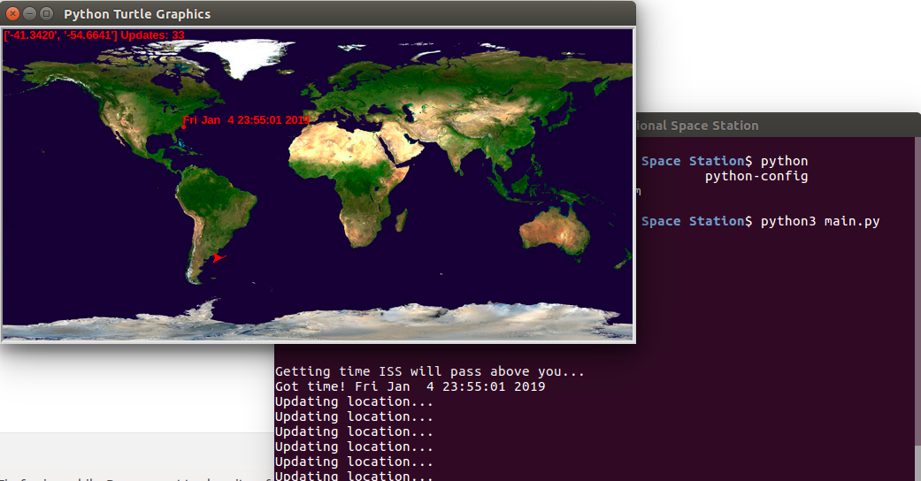
A real-time tracker for the International Space Station (ISS) that fetches live coordinates from the open-source Open Notify API. The application continuously polls the ISS's latitude and longitude, normalizing the data onto a 2D map of Earth.
As the ISS orbits the planet, its path is visualized on the map, offering a dynamic view of its trajectory. The tracker also highlights the next time the ISS will fly overhead a specified location, like my own in North Carolina.
This project combines real-time data with interactive mapping, demonstrating how satellite position data can be used to create visually engaging representations of space-related phenomena.
- Real-time ISS location tracking using latitude and longitude coordinates.
- Path visualization of the ISS's orbit over Earth in 2D.
- Time-based updates showing when the ISS will be overhead a specific location (e.g., North Carolina).
- JavaScript for real-time data fetching and rendering.
- Mapping libraries to project the ISS's 3D trajectory onto a 2D map.
- Open Notify API to fetch live ISS position data.
Clone the repository, run the project, and watch the ISS as it orbits Earth in real-time. You can also track when it will pass over a specific region.